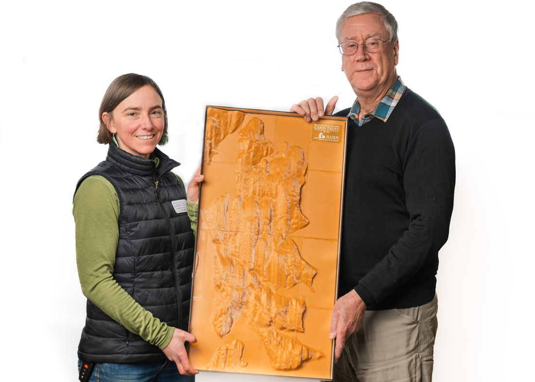
Had you visited BARN in the dead of night over a couple of months in late 2025, you might have heard the hum of 3D printers coming from the Tech Lab. After about 40 hours of that overnight work, which Studio Lead Keith La Plain set up after Open Studios, 16 tiles representing the topography of Bainbridge Island were created. They were assembled into what is now a powerful educational tool for the Bainbridge Island Land Trust (BILT) — without the healthy budget, grant proposals, and time delay initially anticipated.
BILT, which has protected more than 1,400 acres of land for public benefit since beginning its work in 1989, thought it would be great to have something interesting and eye-catching for watershed education. Something that could be taken to events and classrooms that offered a bird’s eye view of the forests and fields, streams and shorelines, that make up this 28-squre-mile home to about 25,000 people.

BILT Community Education Coordinator Megan Rohrssen, who thinks a lot about how best to spark conversations about conservation, wanted something tangible that could be used in a variety of settings. After reading about Iowa State University’s work creating 3D printable terrain models, she figured it could take about a year for her idea to reach fruition. She started with a letter to BARN because she heard it had a 3D printer, letting BARN know she was interested in finding a solution that truly represented the island’s terrain, rather than something more conceptual, and sturdy enough to survive hands-on use.
“People will want to put their fingers on it (‘I live here!’ ‘This is our school.’) … big enough for a group of students (or adults!) to cluster around, locate a place that’s important to them, and then pour sand or water on top to see where the water goes, or how the ‘water’ builds up when something gets in the way,” she wrote.
That letter ended up with La Plain who made it happen in about two months for about $50 in materials. BILT is pleased with its 3D model, which includes a tray and an overlay to depict the island’s roads. It measures about 16 inches by 30 inches.
“It happened like magic,” Rohrssen said. “Every time I bring it out, I learn something myself. Everyone has their own experiences, and this is such a great opportunity to share those experiences. We’re very excited to use it and make it available for teachers. This is a powerful educational tool for islanders of all ages.”
BILT plans on using the map at farmers markets, school visits, and the 4th of July booth and will be reaching out to teachers. Learn more about the Bainbridge Island Land Trust.


Follow Us